Create Designs with Permaculture Design Software (in 2026)
Types of Software for Permaculture Design
When we found ourselves, like most permaculture students, in need of a tool to create our designs, we took a familiar path by relying on standard drawing apps. Using these gave us great creative freedom to draw shapes representing objects we needed. We either created graphics from scratch or used existing libraries. To ensure that the scale was accurate and reflected reality, we had to manually keep track of the measurements.
Looking for ways to create more accurate drawings, we turned to advanced GIS software. While these systems are exceptional for geospatial data processing, they come with a steep learning curve and lack built-in features for permaculture design.
Purpose-built permaculture software sits at the intersection of both options, bridging the gap between artistic flexibility and technical precision. Its specialised tools combine the best of both worlds: real-world scale, terrain data, and intuitive features designed specifically for ecological land design.
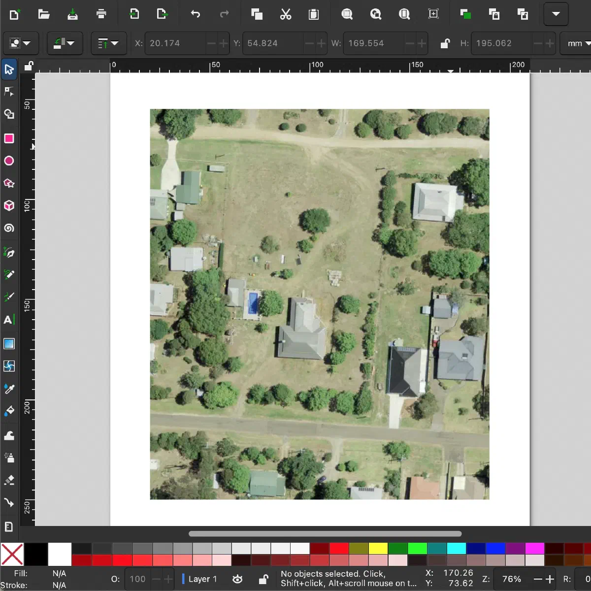
Inkscape: vector graphics drawing tool can be used to sketch land layouts over reference images
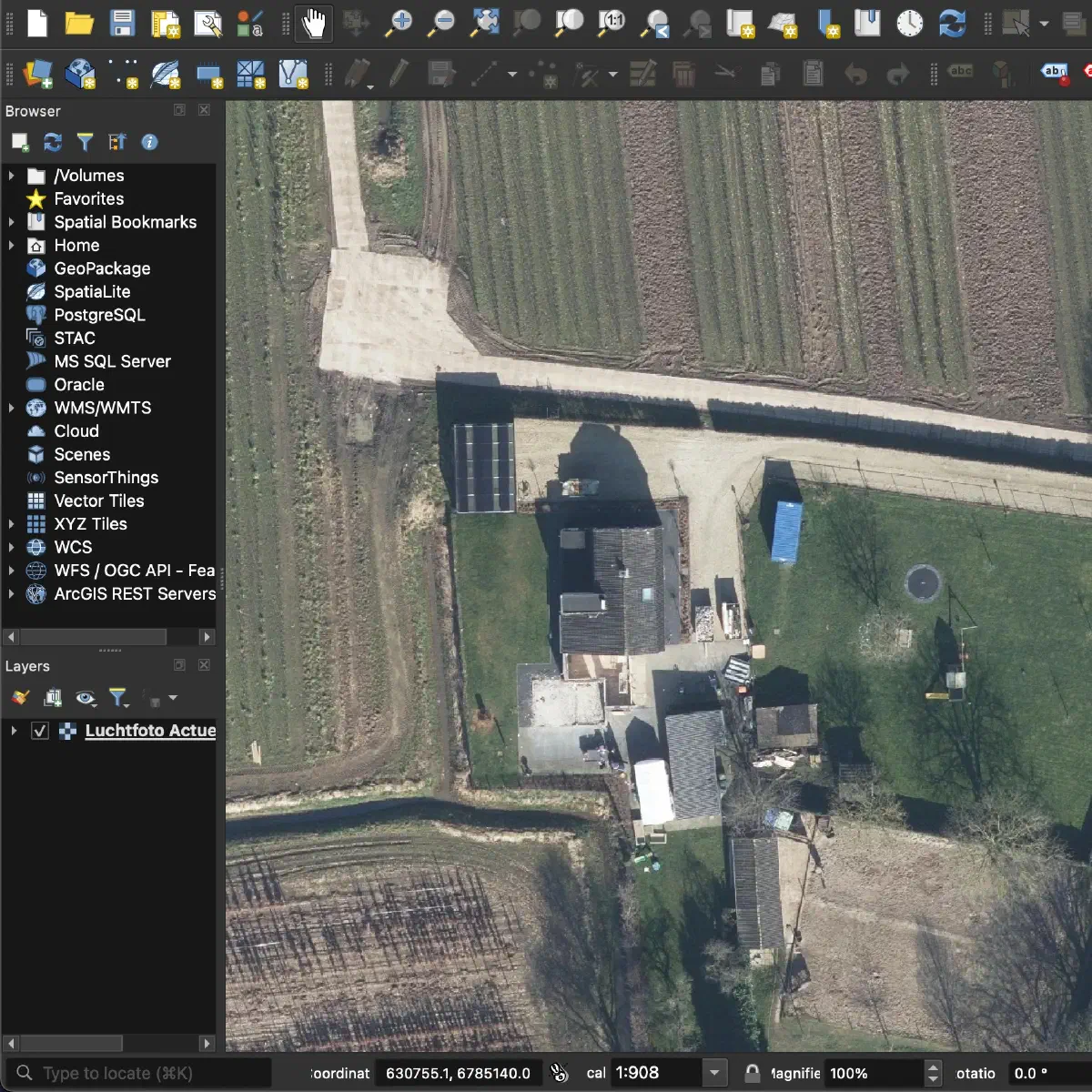
QGIS: an advanced geospatial software allows you to directly work with broad range of geospatial data
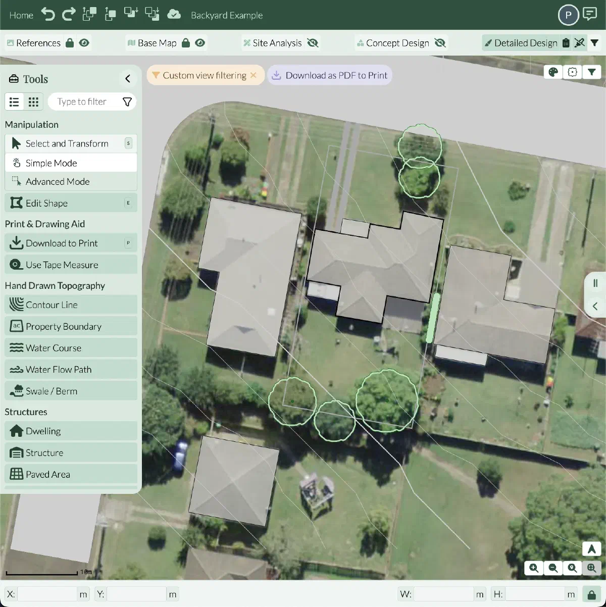
Permiehub: purpose-built permaculture design software featuring automated base map data and tools specific to ecological landscape design
The Right Tool for the Job
Each digital tool had its place and served a clear purpose as our mapping needs evolved. We are going to look in detail at how these three software categories handle real-world land planning to highlight where each one excels and where we ran into natural boundaries during our own permaculture design projects.
Generic Drawing Software
When starting a new layout, graphic design editors like Inkscape, Illustrator, or Procreate are often the first stop. It makes complete sense, as a blank canvas in a graphic app acts like infinite digital tracing paper where you can sketch freely and craft visually appealing concepts. We used Inkscape extensively when designing our own property during a Permaculture Design Course, successfully creating a complete design with all the relevant layers.
While these tools offer fantastic creative freedom, using them for detailed property mapping brings a few practical considerations. Because graphic apps are designed for illustration rather than spatial analysis, certain technical tasks require extra manual effort as a project grows in detail.
- Fixed canvas scaling: Graphic editors operate on standard canvas sizes, such as A4 or A3, rather than real-world dimensions. Setting up a scale-accurate base map requires tracking measurements manually in relation to the page size used.
- Manual spatial inputs: Standard canvases do not have native geographic context, so overlaying terrain contours, plotting exact site boundaries, or calculating seasonal sun angles must be done by hand.
- General layout focus: Generic drawing tools do not automatically calculate plant quantities or spacing, meaning food forest counts and inventory require manual record keeping.
- Setup time and illustration skills: Achieving a polished result often relies on comfortable software fluency and taking the time to build custom symbol libraries from scratch.
Advanced Spatial Software
Recognising the need for geographic precision, some designers pivot toward advanced systems like QGIS or AutoCAD.
QGIS is a powerful open-source platform and the gold standard for importing local government spatial data, processing high-density LiDAR terrain data, or analysing broadacre hydrology. If you need to map regional watersheds or parse multi-gigabyte spatial datasets, QGIS is a great tool to explore.
We use QGIS to explore open datasets, such as aerial imagery and digital elevation models. These datasets are often provided by governments and councils for public use, depending on the exact licence conditions, making it possible to extract and manually bring this spatial data into a drawing app for the creative process.
While advanced platforms provide data processing features, using them for individual site designs involves a few technical considerations. Because these systems are built for large-scale spatial analysis rather than intuitive landscape layout, applying them to permaculture property planning requires extra effort.
- Technical complexity: Mastering QGIS requires understanding spatial data types and coordinate reference systems, searching for relevant data sources, and adding them to your project.
- Spatial analysis focus: While QGIS excels at raw data processing, it prioritises data analysis over providing detailed ecological tools like arranging plant spacing.
- Setup time investment: If your primary goal is to design a homestead, hobby farm, or backyard, the steep learning curve might delay the actual landscape design process.
Permaculture-Specific Design Tools
Specialised permaculture design tools offer a practical middle ground between generic drawing apps and complex spatial engineering platforms. Rather than choosing between creative freedom and geographic precision, permaculture-specific tools provide features built specifically for ecological landscape design.
While purpose-built platforms streamline the mapping process, applying them to property planning involves understanding their specific functional focus. Because these tools are tailored directly to site stewardship rather than general graphic design or raw data processing, they integrate geographic context with intuitive layout features to support the overall planning journey.
- Automated base mapping: Built-in tools import scale-accurate aerial imagery, property boundaries, and contour lines, avoiding manual scale calculations or raw geospatial file management.
- Ecological layout elements: Pre-built components, such as planting rows, garden beds, and water infrastructure, simplify site layout. Planting features often calculate plant quantities and row spacing automatically.
- Integrated site analysis: Features for mapping seasonal sun paths, prevailing winds, and site sectors allow designers to evaluate environmental influences directly on the canvas.
- Structured design workflows: Canvas layers are organised around the permaculture planning process, moving sequentially from base map preparation and sector analysis to zone layout and detailed element placement.
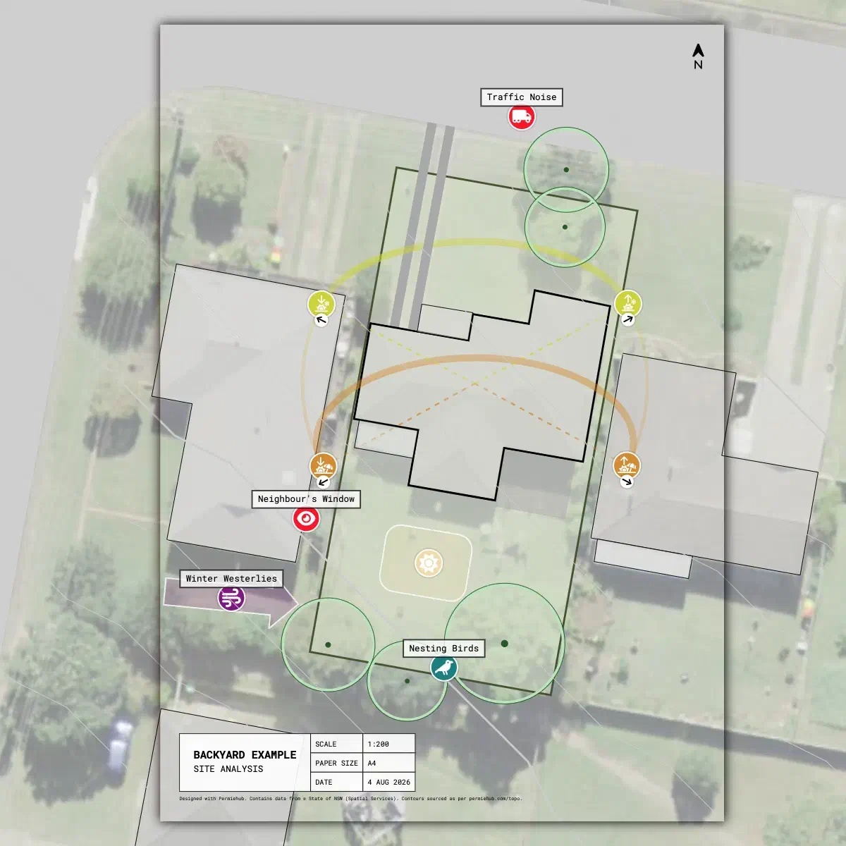
Permaculture site analysis map showing sector overlays and sun path visualisation over aerial property imagery (Permiehub)
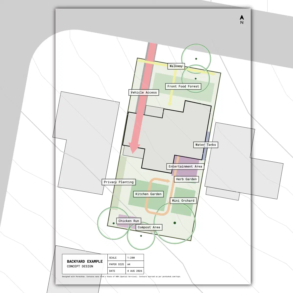
Permaculture zone design layout with custom labels created using specialised permaculture design software (Permiehub)
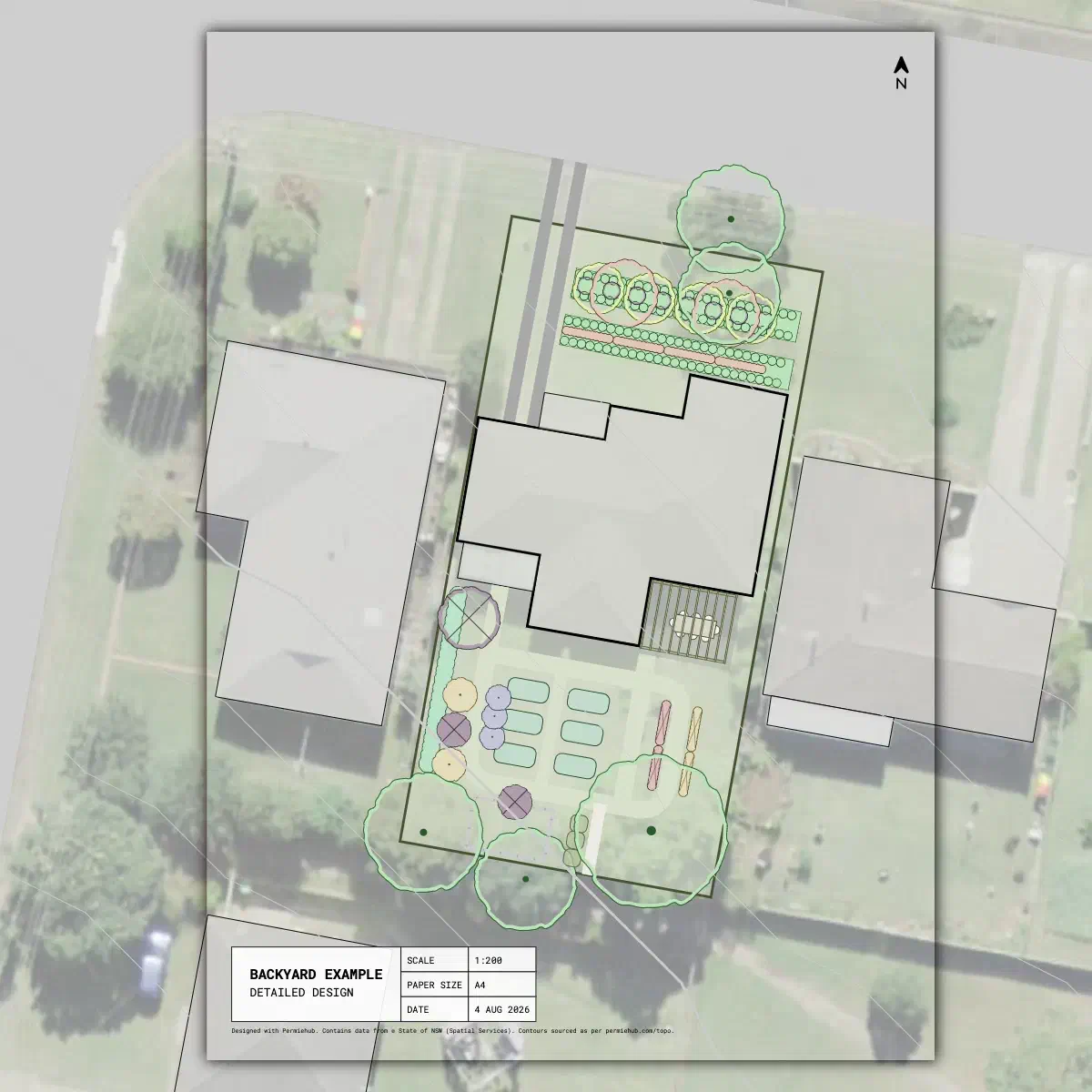
Detailed design layout created with specialised permaculture design software (Permiehub)
Choosing the Right Workspace for Your Land
Ultimately, the best software is the one that stays out of your way and lets you focus on land stewardship and the design process itself.
Artistic and conceptual sketching: Drawing apps such as Inkscape, Krita, or Procreate suit projects that prioritise illustrative freedom over strict real-world scaling.
Heavy technical and spatial processing: Advanced platforms like QGIS excel when handling multi-gigabyte spatial datasets, broadacre hydrology, or raw LiDAR files.
Streamlined permaculture design: Purpose-built software like Permiehub generates scale-accurate base maps instantly, allowing you to design in real-world dimensions without setting up canvas scales manually.
Start Designing with Permiehub
As you can tell, we are biased towards Permiehub. After all, we built it from the ground up specifically for permaculture design. If you want to see how it works in practice, read our step-by-step guide on how to create a scale-accurate base map.
Ready to map your land? Start designing with Permiehub and explore our specialised tools with a 30-day trial of the Starter Plan. If you decide to cancel during the trial, your account transitions automatically to our free Community Plan so you can continue using our free tier. See Plans to learn which plan suits your project best.
Start Trial Today